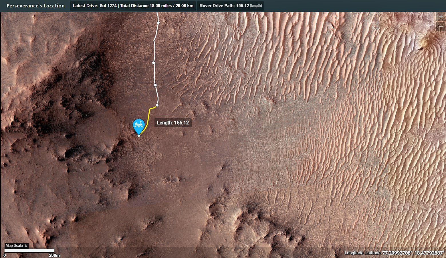
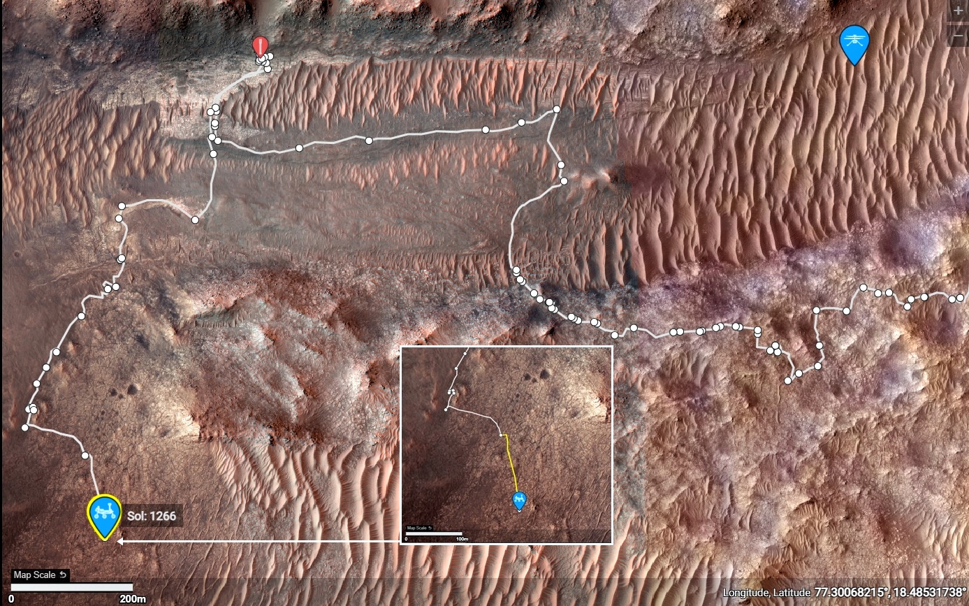
Screen shot from : https://mars.nasa.gov/maps/location/?mission=M20
Screen shot from : https://mars.nasa.gov/maps/location/?mission=M20
Drive was during September 19, 2024 - Data from JPL

Awaiting the official distance and the updated traverse map.
Looking at the post drive images I presume that we are still on the margin unit, but very close to the basal unit of the crater rim (just beyond the workspace).
JPL stated that "Dox Castle" is a major science waypoint, but we're probably a little south of the location shown on an earlier map, but we are close to the transition zone.
Except for a series of short walkabout drives we could be around here for some time examining the transition between the rim and the rocks formed in the ancient lake. I'll share the official traverse map and drive data as soon as it is released.
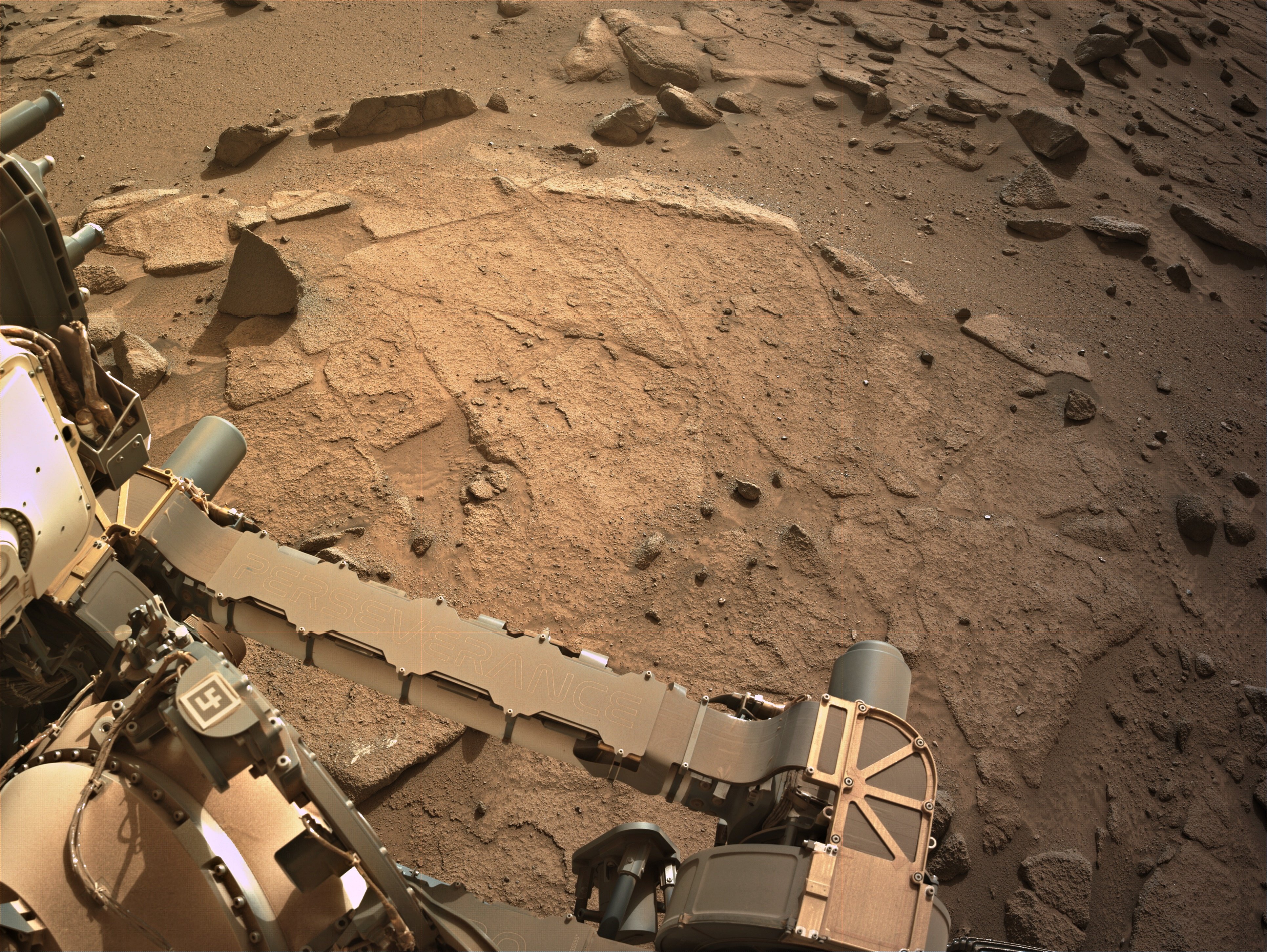
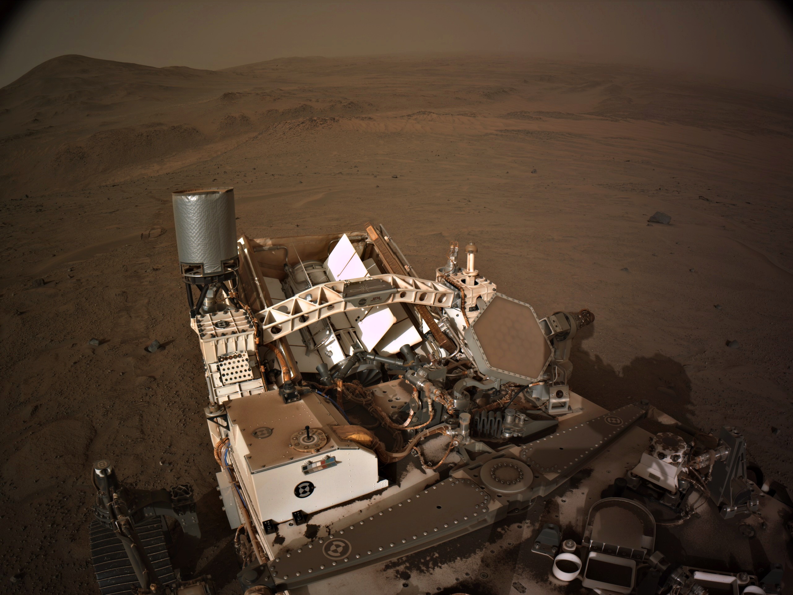
Attached is a 9-tile end-of-drive L-NavCam composite, featuring the rover's robotic arm workspace
Size - 3862x2902px
Assembled in MS-ICE.
Site - 96-4812.
Sol 1274 - September 19, 2024.
Credits: NASA/JPL-Caltech
Perseverance Mars rover is on its ascent to the rim of Jezero Crater, and it captured a portion of the journey with one of its navigation cameras. Forty-five frames were stitched together to create this video showing the rover's progress on Aug. 22, 25, and 26, 2024, the 1,247th, 1,250th, and 1251st Martian days, or sols, of the mission. During the time period captured, Perseverance covered a distance of about 530 feet (160 meters) and gained about 115 feet (35 meters) in elevation.
Credit: NASA/JPL-Caltech/PIA26376

Dox Castle will be our first chance to do rim science, to search for evidence of the transition between the margin and rim materials, and to start piecing together the stratigraphic history of the rocks that make up the rim of Jezero crater.
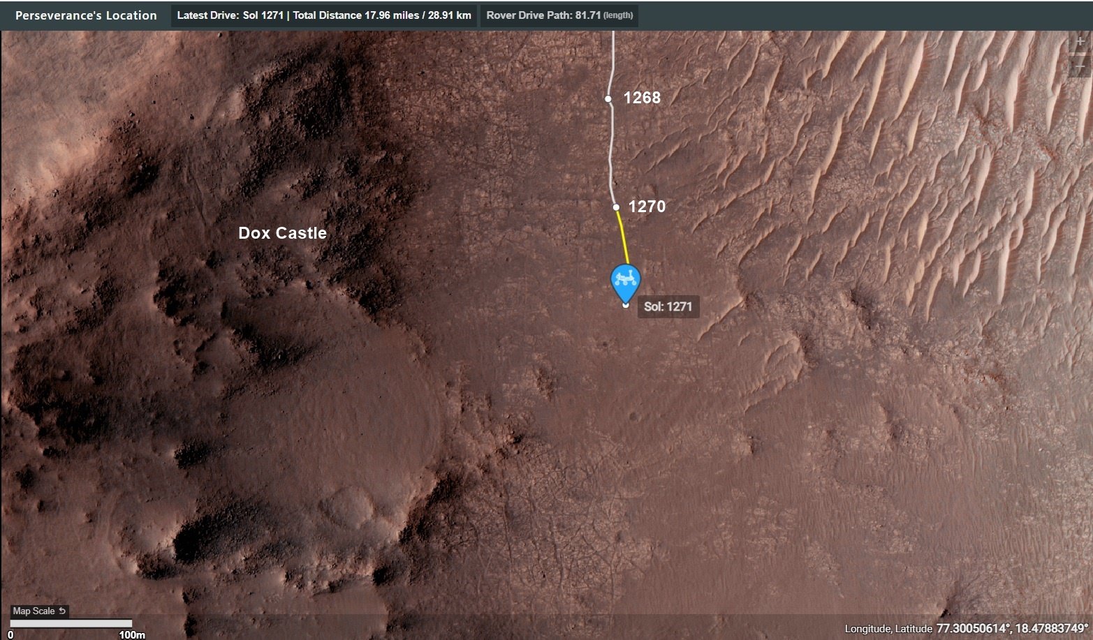
4-tile end-of-drive NavCam. The terrain in front of the rover (small pebbles) in the sand, is often a good sign of reasonable driving conditions. We're not too far from "Dox Castle" (a possible science waypoint), so we may see the rover change course soon.
Awaiting the post drive data (JSON) and official map
MG seems to like click bait titles for his YT videos. I try to ignore the titles so I can enjoy the content :)
Hopefully we'll see more funding on Earth to research on similar coatings that occur here on Earth
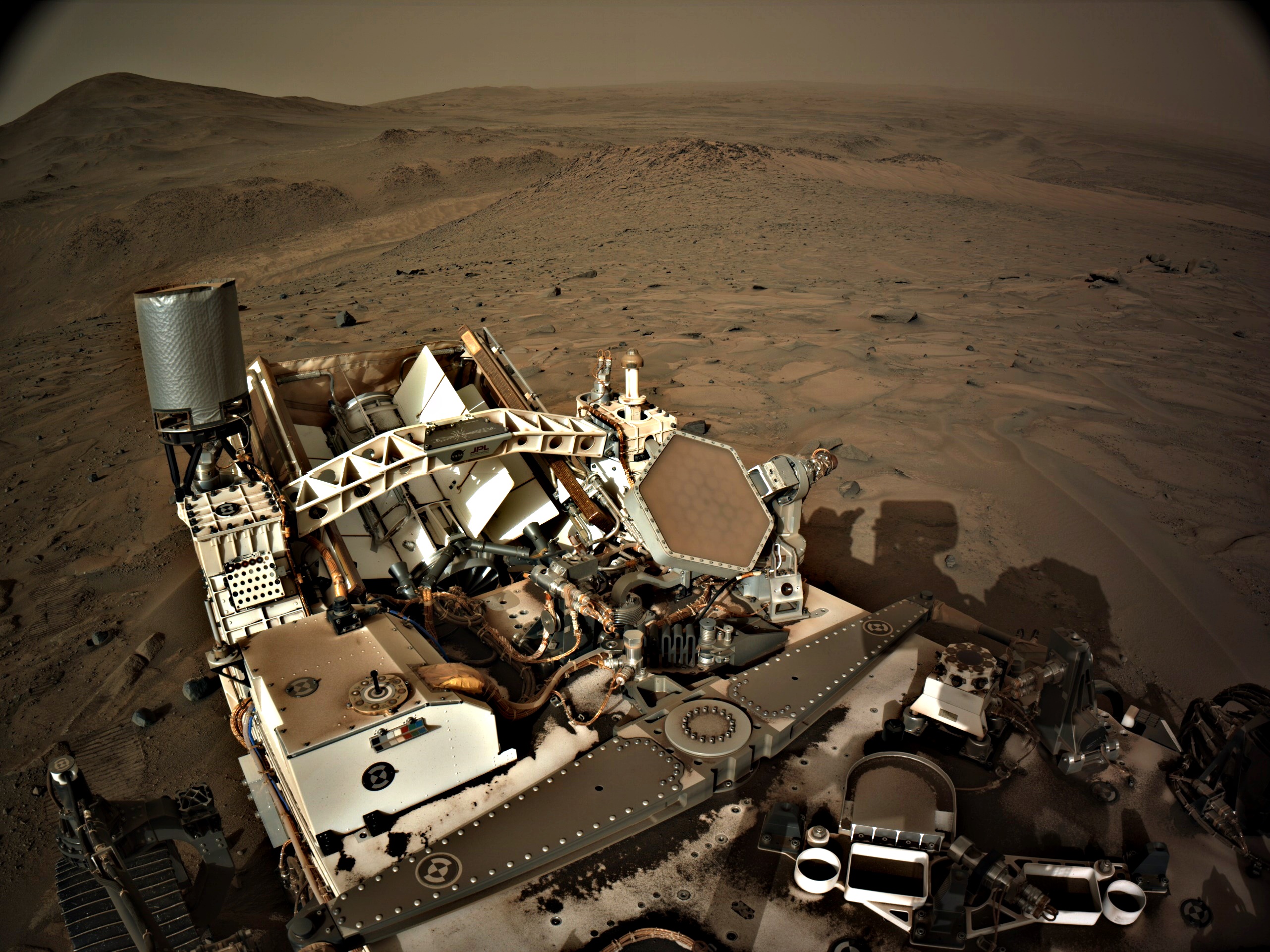
The climb continues with another good drive/climb during sol 1268. The views from this record elevation are a little spoiled by elevated dust levels. Let's hope the dust subsides a little before the rover drives out of the crater. NASA/JPL-Caltech/MSSS
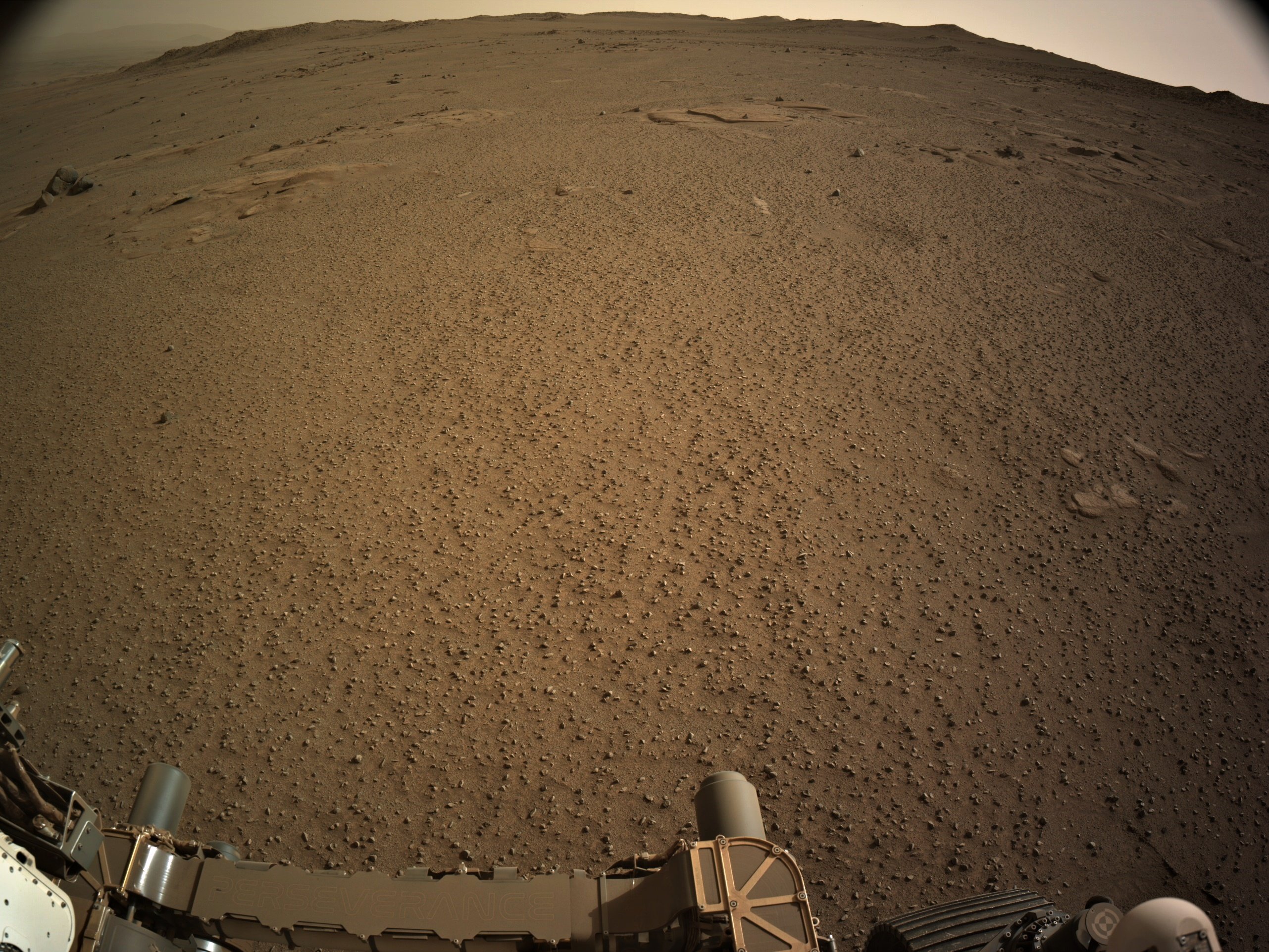
Screen shots from the official map - https://mars.nasa.gov/maps/location/?mission=M20
Data acquired from JPL's JSON feeds

4-tile NavCam - Looking back downslope after a climb of 20.36 meters (66.8 ft)
And all the low-lying terrain in this image was under water…
See post (just posted) for the estimated extent of the Paleo Lake : https://lemmy.world/post/19643561
Is that tire patterns in the top left corner?
They are small ripples in the soft sand between rocks, if you look in the NavCam images of the workspace on sol 1254 you can see many more examples.
These ripples are formed by the wind (aeolian process).
I personally don't care about long winded posts, I think you'll find those that are seeking a deeper understanding will not care either. There will always be those who will want a TLDR post, but you can leave that to others to condense :)
Look forward to your posts (whenever you have time) :)
point-to-point 1419.73 meters (using the coordinates), but a tad further as the rover is climbing the rim now.
The rover is now 101.06 meters higher than the rover and that adds 0.27 meters to the point to point distance which is 1420.0 meters :)
The point-to-point distance between the helicopter and the rover at the locations shown on this image is 1419.7 meters (4657.7 feet)
The crater rim rises to a max of 590 meters from the floor of Neretva Vallis that carves through the rim. But the rover has options to cross the rim at a little less than that depending on conditions encountered on the traverse. It's a steep climb with sections around 23% slope angel.
Love it when knowledgeable folk join the chat :) It takes these posts to a whole new level :)
I'm not a geologist, but from what I understand the red colour is a good indicator of iron and oxygen at the time the sediments were laid down.
The current location is Serpentine Rapids in the upper right of the map (North is up)
The route (shown in blue) that the agency's Perseverance Mars rover is expected to take as it climbs up the western rim of Jezero Crater is superimposed on this image taken by the HiRISE camera aboard NASA's Mars Reconnaissance Orbiter.
At upper right is "Serpentine Rapids," the final geologic location of interest for the Perseverance science team before the rover begins its ascent. "Dox Castle" is a region the science team would like to explore during the rover's ascent. Two of the first regions the science team wants study at the top of the crater are "Pico Turquino" and "Witch Hazel Hill."
Imagery from NASA's Mars orbiters indicates that Pico Turquino contains ancient fractures that may have been caused by hydrothermal activity in the distant past. Orbital views of Witch Hazel show layered materials that likely date from a time when Mars had a very different climate than today. Those views have revealed light-toned bedrock similar to what was found at "Bright Angel," the area where Perseverance recently discovered and sampled the "Cheyava Falls" rock, which exhibits chemical signatures and structures that could possibly have been formed by life billions of years ago when the area contained running water.
The distance the rover will drive to get from Serpentine Rapids to the Aurora Park/Pico Turquino area is about 1.1 miles (1.8 kilometers); the change in elevation between the two locations is about 980 feet (300 meters). The distance covered to go from Aurora Park/Pico Turquino to Witch Hazel Hill is about 1.2 miles (2,000 meters) and the change in elevation is about 820 feet (250 meters).
Try zooming in and check out the fringing at the edges of many of those rocks. They are ventifacts, carved by the by wind blown sand over eons. Ventifacts are formed by aeolian processes, hence the title. ☺️
BattleBots on Mars :)