30
this post was submitted on 14 Aug 2024
30 points (100.0% liked)
NASA's Perseverance Mars Rover
1376 readers
25 users here now
On the plains of Jezero, the secrets of Mars' past await us! Follow for the latest news, updates, pretty pics, and community discussion on NASA and the Jet Propulsion Laboratory's most ambitious mission to Mars!
founded 1 year ago
MODERATORS
you are viewing a single comment's thread
view the rest of the comments
view the rest of the comments
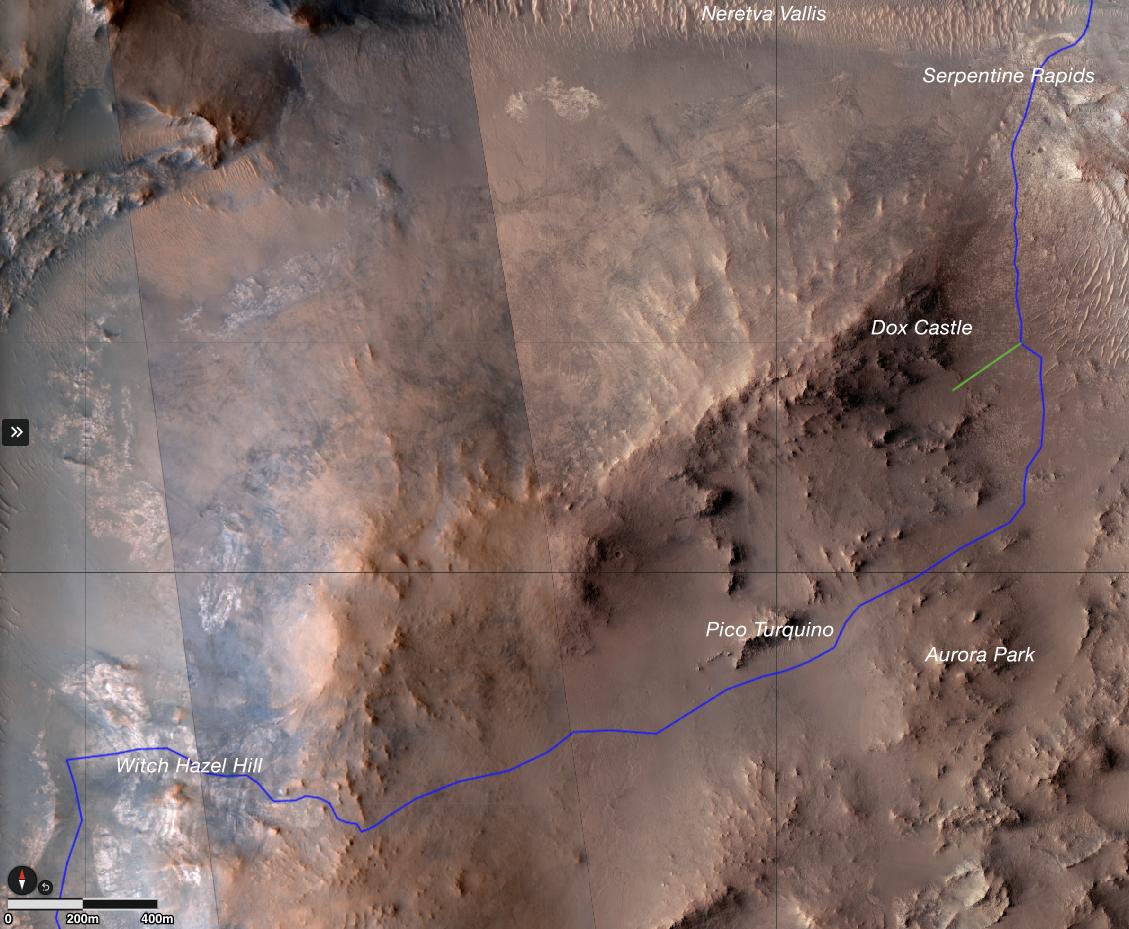
The current location is Serpentine Rapids in the upper right of the map (North is up)
The route (shown in blue) that the agency's Perseverance Mars rover is expected to take as it climbs up the western rim of Jezero Crater is superimposed on this image taken by the HiRISE camera aboard NASA's Mars Reconnaissance Orbiter.
At upper right is "Serpentine Rapids," the final geologic location of interest for the Perseverance science team before the rover begins its ascent. "Dox Castle" is a region the science team would like to explore during the rover's ascent. Two of the first regions the science team wants study at the top of the crater are "Pico Turquino" and "Witch Hazel Hill."
Imagery from NASA's Mars orbiters indicates that Pico Turquino contains ancient fractures that may have been caused by hydrothermal activity in the distant past. Orbital views of Witch Hazel show layered materials that likely date from a time when Mars had a very different climate than today. Those views have revealed light-toned bedrock similar to what was found at "Bright Angel," the area where Perseverance recently discovered and sampled the "Cheyava Falls" rock, which exhibits chemical signatures and structures that could possibly have been formed by life billions of years ago when the area contained running water.
The distance the rover will drive to get from Serpentine Rapids to the Aurora Park/Pico Turquino area is about 1.1 miles (1.8 kilometers); the change in elevation between the two locations is about 980 feet (300 meters). The distance covered to go from Aurora Park/Pico Turquino to Witch Hazel Hill is about 1.2 miles (2,000 meters) and the change in elevation is about 820 feet (250 meters).