
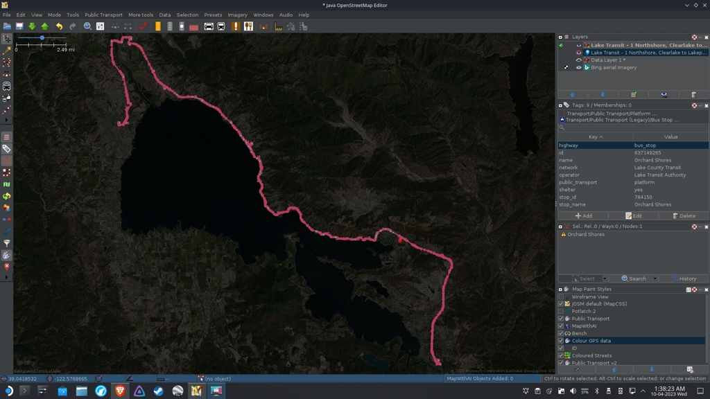
67 stops, phew.... Time to sleep now.
Everything #OpenStreetMap related is welcome: software releases, showing of your work, questions about how to tag something, as long as it has to do with OpenStreetMap or OpenStreetMap-related software.
OpenStreetMap is a map of the world, created by people like you and free to use under an open license.
Join OpenStreetMap and start mapping: https://www.openstreetmap.org.
There are many communication channels about OSM, many organized around a certain country or region. Discover them on https://openstreetmap.community
https://mapcomplete.org is an easy-to-use website to view, edit and add points (such as shops, restaurants and others)
https://learnosm.org/en/ has a lot of information for beginners too.
67 stops, phew.... Time to sleep now.
And on a Steam Deck too! Nicely done.
Thanks dude!
How did you add them? Did you draw a line for the route first? There's only one route in my area, so I want to add the others :)
I found the routes to my transit system on transit.land, then exported the route and stop geojson files. I converted the route file to Gpx so I can change the line style and see it better. Then I used the public transport plugin to help add info to each stop. It was pretty repetitive, and I'm not even finished yet. I still need to add the actual route and add both route and stops to a relation.
Thanks for replying :)
That sounds fairly complicated, so I'll make sure that I've done my research and practiced before I try to add the routes. I didn't know about transit.land, so that's really helpful, thanks :)
If you're adding from an external source make sure you've checked the licence is OK, not everything that's "open data" is as permissive as OSM requires.
https://wiki.openstreetmap.org/wiki/Import/ODbL_Compatibility
That's a good point, thanks :)
Awesome, thanks. Keep up the hard work!
Thank you!
Looks a bit Mandelbrot-y to my eyes
Very good
