this post was submitted on 03 Mar 2025
518 points (99.4% liked)
Cartography Anarchy
1241 readers
359 users here now
A community for Cartographers with nothing left to lose.
Rules:
Don't be awful Lemmy Guidelines Still Apply.
No direct upload images This is hosted on Lemm.ee- to post images, you must use an image upload service like Imgur to post maps.
We are agents of chaos I've created this to be the alternative to the community I used to manage on the website that shalt not be named "mapporncirclejerk"
Live and let die Meme trends happen, so please don't message mods asking to take down maps that are repetitive to a bit.
Reposts Vs. Covers Not all reposts are evil- if someone posts something that has been done years ago, it serves to bring old memes to the new users. I call these meme covers. However it can be done in excess which makes it a repost and spam. Mods will determine if a post is a cover or a repost.
No impersonating mods I can't believe I had to make this rule.
No harassing mods on an appeal We can talk it out, and we will be acting in good faith when making decisions. If you disagree with a removal, you are free to message for clarification or to appeal by giving some added context.
Bans Bans will be set to a maximum of 365 days for humans, and a minimum of 365 years for bots. I believe people can change, so if you are banned for good reason, do know that it is not permanent, it is just a way to say "take time to grow and come back when you are ready".
founded 1 year ago
MODERATORS
you are viewing a single comment's thread
view the rest of the comments
view the rest of the comments
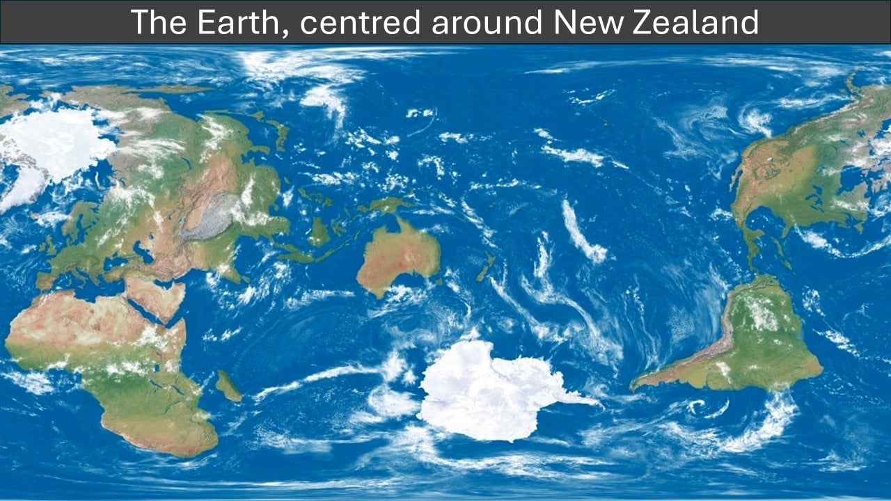
This is more centered around Fiji tbh
It's actually centred just off the coast of the southeastern corner of Australia
Maps without the correct concept of New Zealand.
Shhh, you'll give away the true location of New Zealand.
The biggest landmass nearest to the edge is Africa (+a slight margin for human pleasure) so it probably made sense to keep that one intact for the readability of the map (cutting Alaska and Canada isn't actually that much km²).
It could have been rotated slightly to move Africa away from the edge, Canada back towards the rest of the Americas, then a slight move could avoid splitting any land, and NZ could be better centred
It's Tassie time!
How do you do this by accident? It would have cut off less of Alaska done properly, even.
Less of Alaska, but more of Africa.
Maybe OP is Mauritanian.
But that would cut off more western Africa than the entire size of Alaska.
Hmm, I guess I didn't account for the projection. It does look like it's compressing Africa here.
That's not Fiji...